


The Empire State Plaza: Urbanism in Albany, NY
Note: this is a reader-submitted piece. Feel free to reach out in the comments if you’re interested in featuring a post on Andy Talks Urbanism!
For the first half of the 20th century, Albany, NY was not, just as it is not now, a bustling metropolis like its sister down the Hudson River. But it was a city brimming in its own rites. For half of the year, legislators moved between the State Capitol, bars, and hotels as they spent long session weeks in the capital city. From 1890, electric streetcars moved Albany’s residents–ironically known as Albanians–between neighborhoods such as Center Square and the South End. 19th and 20th century urban residents lived in Italianate row homes, reminiscent of those seen across Baltimore, Philadelphia, and Boston. It also was not a stranger to public works–in 1928, a state office building, completed in the period’s Art Deco style, rose 34 stories above the city, across from the street from the Capitol. The Alfred E. Smith Building still stands today; state bureaucrats still traverse its halls.

Albany from above, in April 1937, before the construction of the Empire State Plaza. Image courtesy of New York State Archives, State Education Department.
Unfortunately though, the streetcar system was disbanded by the end of World War II, and many of Albany’s oldest neighborhoods have not been treated with the care and appreciation their history merits. Of course, a lot of this is attributable to national trends that Andrés has discussed here, such as white flight from urban centers, and the blight of highway construction. The concrete veins and arterials are especially noticeable in Albany–the Hudson Riverfront is largely blocked from view by the overpasses carrying Interstate 787. Its concrete lines spliced across the heart of the city from the Riverfront, creating a monstrous, circular interchange with four levels of asphalt ramps towering over each other, running inland via the South Mall Arterial.
The South Mall Arterial feeds directly into Albany’s greatest concrete monument: the Empire State Plaza. Running largely north-south, the Plaza is bookended to the north by the Romanesque, neo-Gothic State Capitol that predates it, and the brutalist State Museum and Library building to the south. Across the western length of the Plaza stand four, identical glass and granite buildings, 22 stories high. These stark ducklings are known only as Agency Buildings 1-4, and are stuffed with state offices. On the eastern side stands a similar building, larger in footprint and twice as high. The Corning Tower, also holding state offices, is the tallest skyscraper in Upstate New York. Finishing off the Plaza skyline is The Egg, a round, concrete performing arts venue that more closely resembles a bowl than an egg. Underneath the Plaza and within its foundations is a liminal space known to state employees as The Concourse. It provides walkways between all of the plaza’s buildings, along with a food court and amenities comparable to an airport terminal. The art that lines the Concourse’s walls is a testament to the mid-20th century modernity and geometry that shaped the structure.
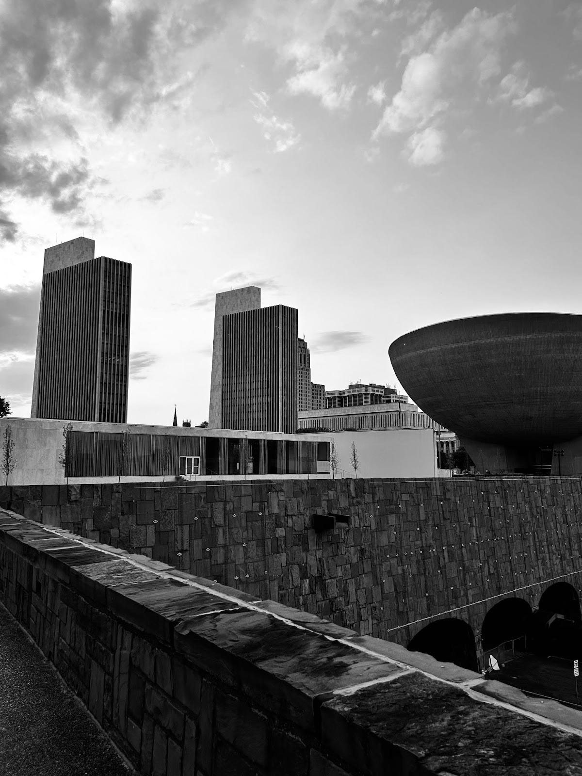
Views of The Egg, and Agency Buildings 3 and 4 on the Empire State Plaza. Image work of the author.
Constructed from 1965-1976, the Plaza was conceived by Governor Nelson Rockefeller, in the early 1960s, during a visit by members of the Dutch royal house. The Governor, when showing the entourage through the center of the city, was embarrassed by its increasing dilapidation and lack of soaring monuments or impressive skylines. His ego conceived of the Empire State Plaza, and it was built on top of the razed neighborhoods populated largely by lower-class, ethnic enclaves. The neighborhoods that survived, such as Center Square and the Mansion Area, were disconnected from their history and each other, as a result of the construction.
The Plaza, an impressive work though it is, represents a failure in the type of people-centered urban design planners should strive for. The length of the plaza disconnects people between neighborhoods, and displaced thousands more from ancestral homes. Though the Plaza includes a bus stop, the area is dominated now by the state workforce, which largely comes into Albany from outside the city limits. This limits the utility of intercity bus connections, and makes their current structure impractical for many city-residents, since it is catered to a population that exists only during business days, in a Plaza that is largely vacant after the bureaucrats head home. Though incredibly convenient as a structure during the workday, the Plaza is little more than a concrete barrier between neighborhoods on weekends and holidays. And it shows how the people of Albany travel and live. Neighborhoods are slowly suffering from haphazard city service and maintenance, and the disconnects between neighborhoods makee it difficult for local businesses to establish markets and long-term niches.
Public works, employee offices, and monumental spaces should not be condemned on their whole. Even the Empire State Plaza, as a reflection of a mid-century period in architecture and state office complexes, serves important functions. But these spaces should be thoughtfully incorporated into the urban areas they occupy—integrated with communities, to serve them and enhance their purpose. The Empire State Plaza, perhaps, might have been a greater compliment to Albany if it was built more thoughtfully and surgically to flow with the surrounding neighborhoods and existing architecture. Offices might exist as lines of neo-gothic buildings complementing the row homes nearby, and connected by through-running streets and buslines, rather than limited-access, car-centric arterials. Integration of office buildings with local commercial zoning would have integrated out-of-town bureaucrats with local businesses, rather than shepherding them to a corporate food court. The results would not have been perfect–homes would still have been replaced with the offices necessary to house a growing bureaucracy, and many would still take cars into the city center, unless inter-locality transport was more graciously thought out and provided for in the Capital Region. But such an approach would have prevented a blight of concrete, and encouraged a cooperative relationship between the city, its businesses, its people, and the public officials who work there.
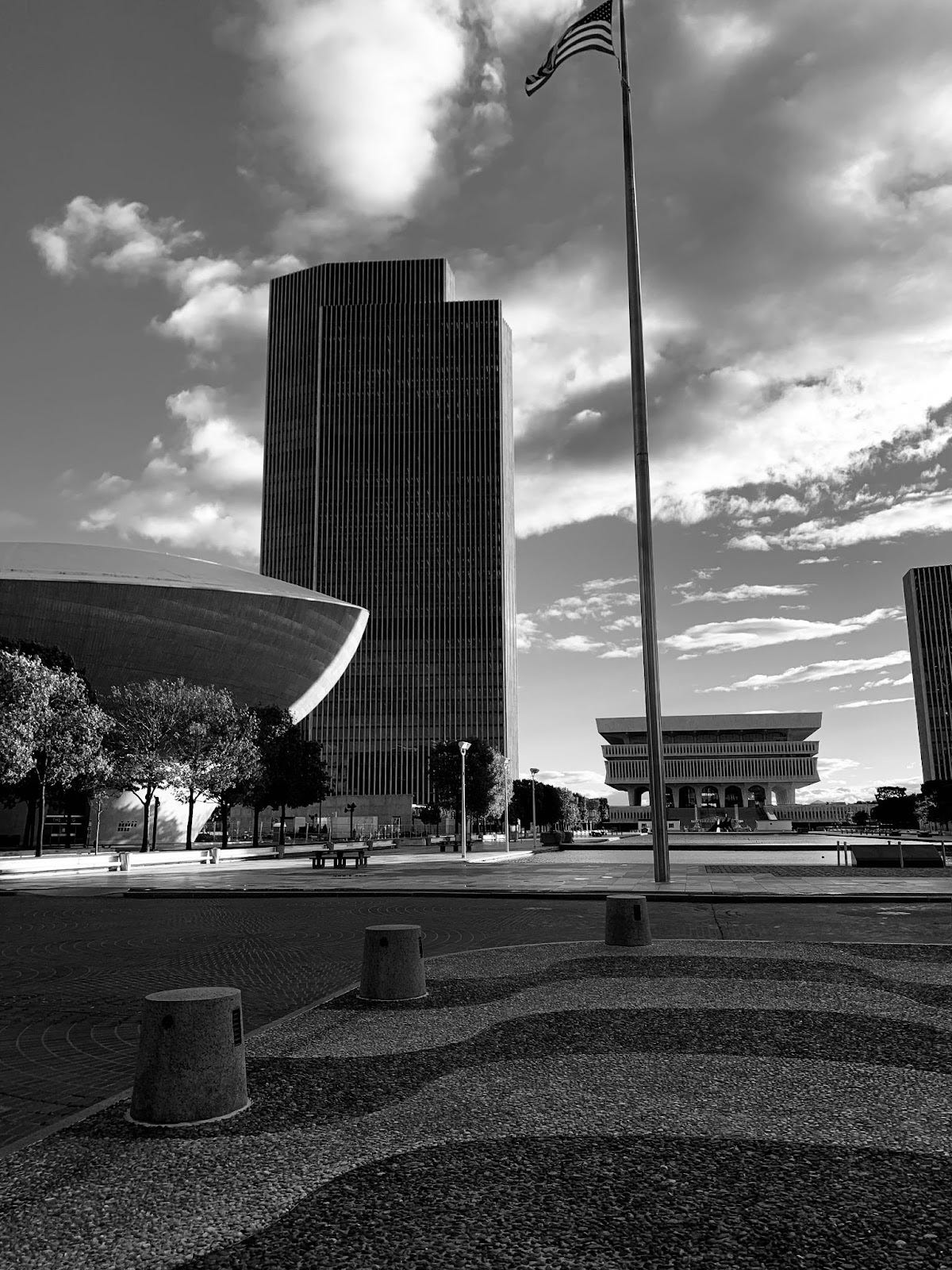
Looking south from State Street: The Egg, the Corning Tower, and the Cultural Education Center (home of the State Museum). Image work of the author.
I would like to thank Andrés for providing me a platform to provide my musings and thoughts on Albany. As I learn more about the place where I live, and discuss urbanism through Andrés’ posts, I could not help but think that Albany would be an illustrative case-study to share with him and his audience. Thank you for taking the time to read!
– A Friend of the Blog
I would be happy to write a post based on this work on linear (carfree) cities.
https://docs.google.com/document/d/1oSzoLWTgx1udLmLTC1U1moCFzdIYB2tWP-i4f9W21ns/edit?usp=drivesdk